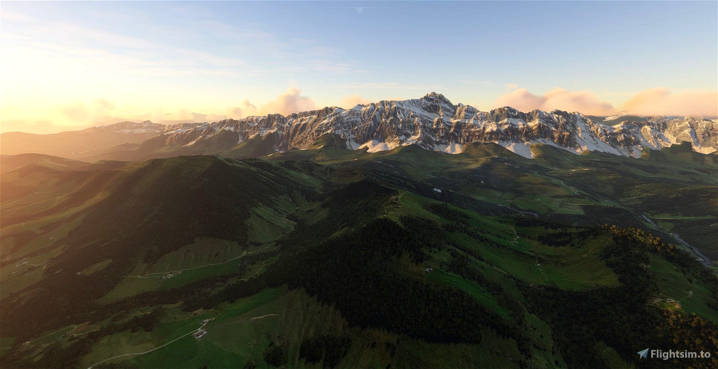
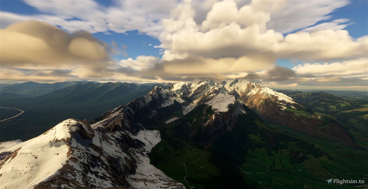
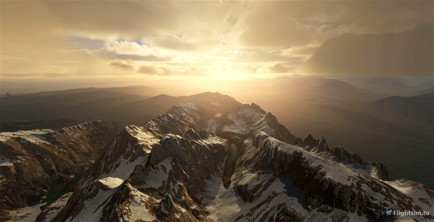
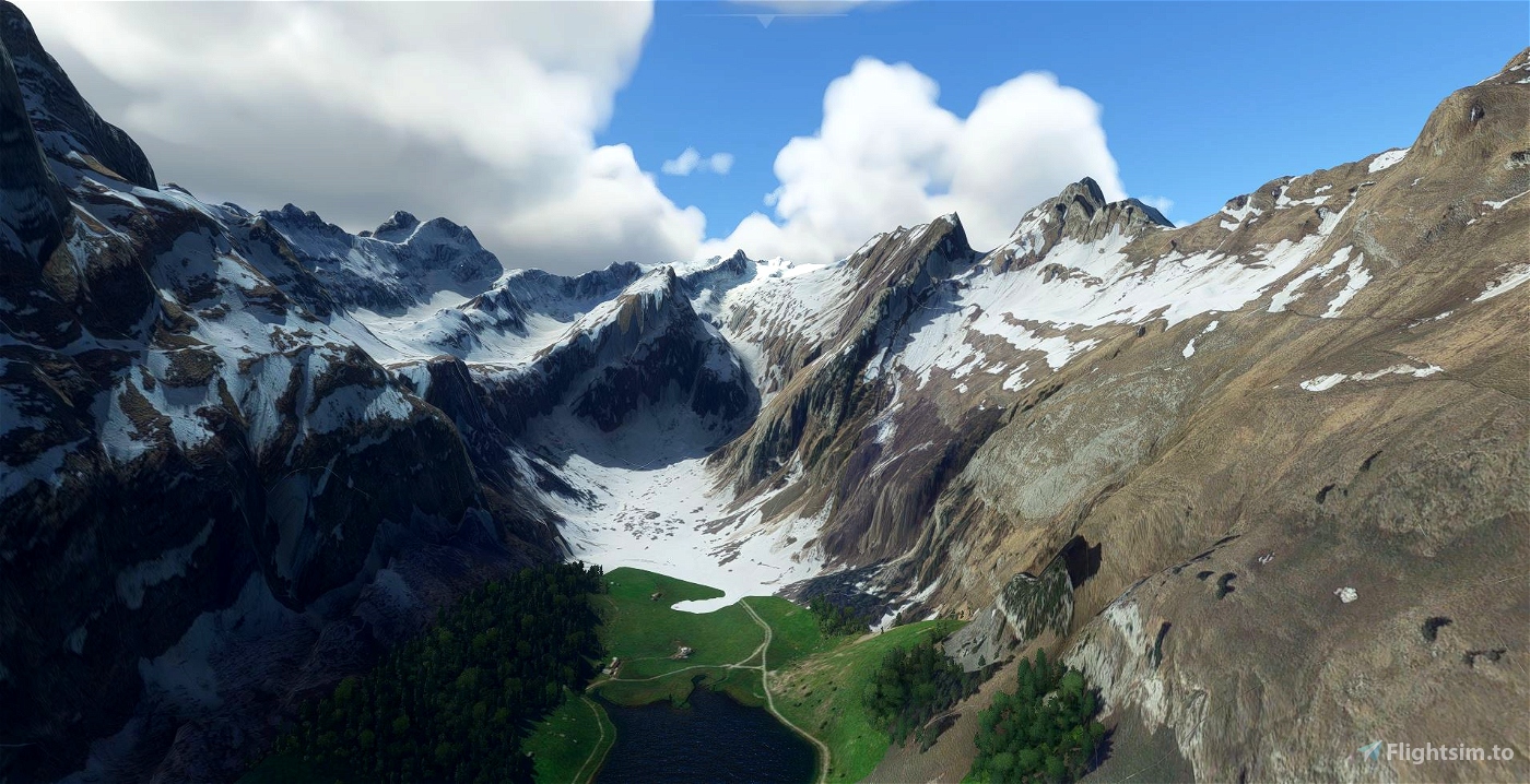
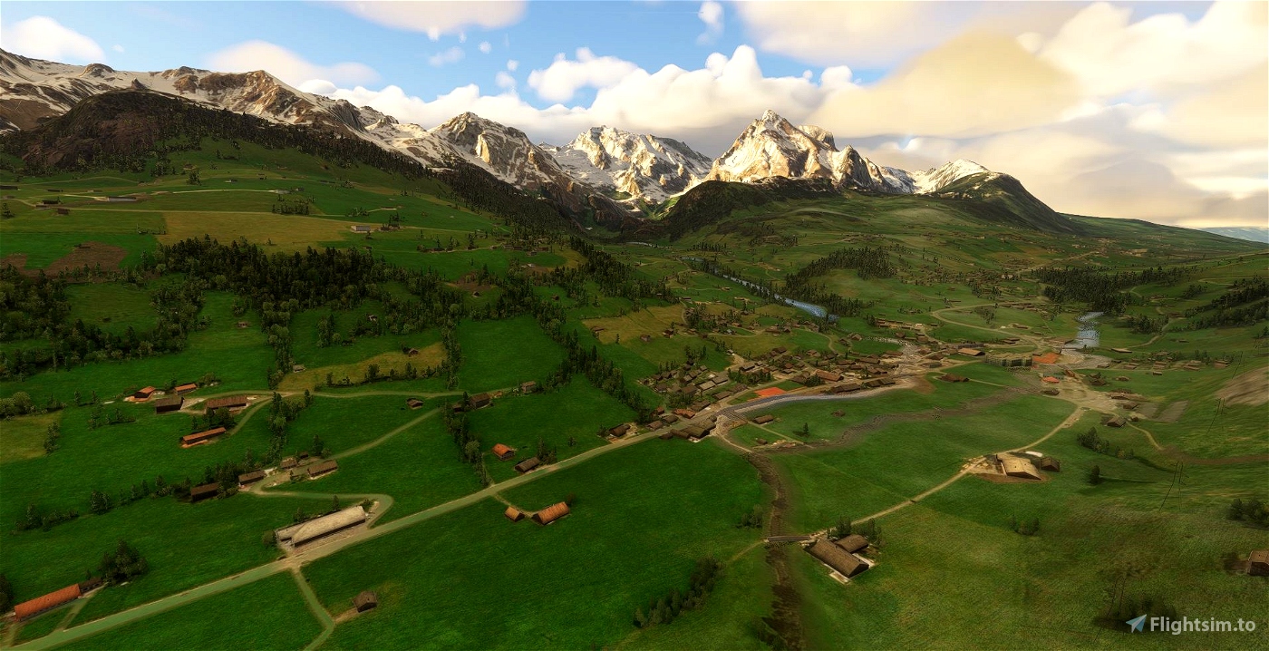
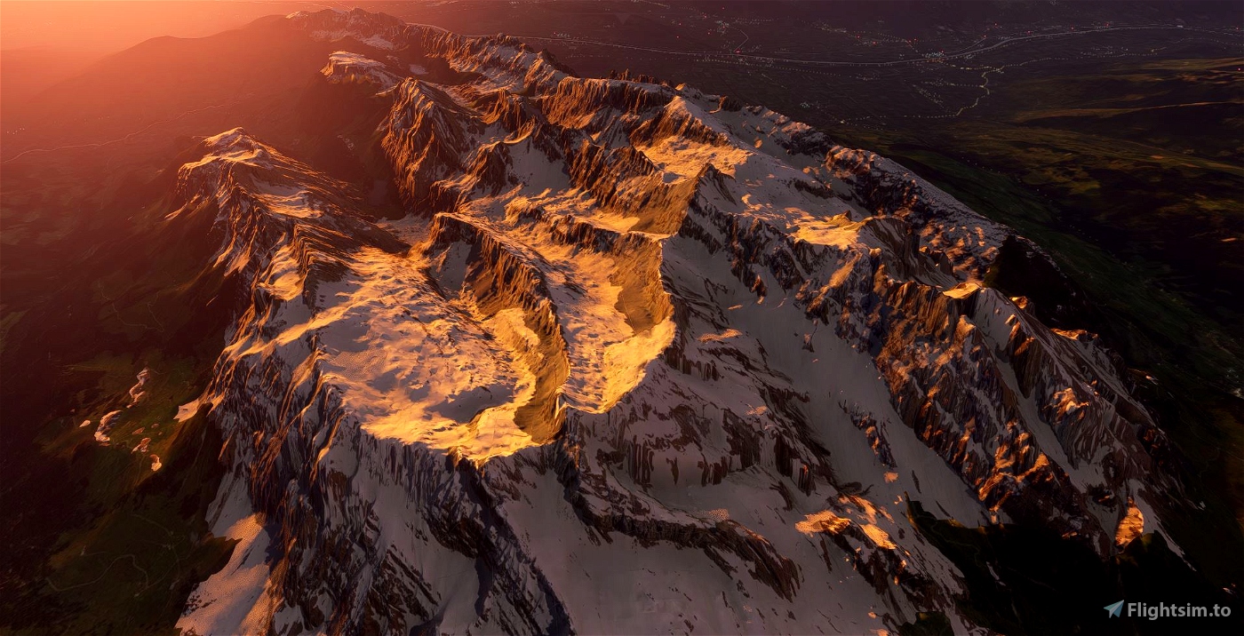
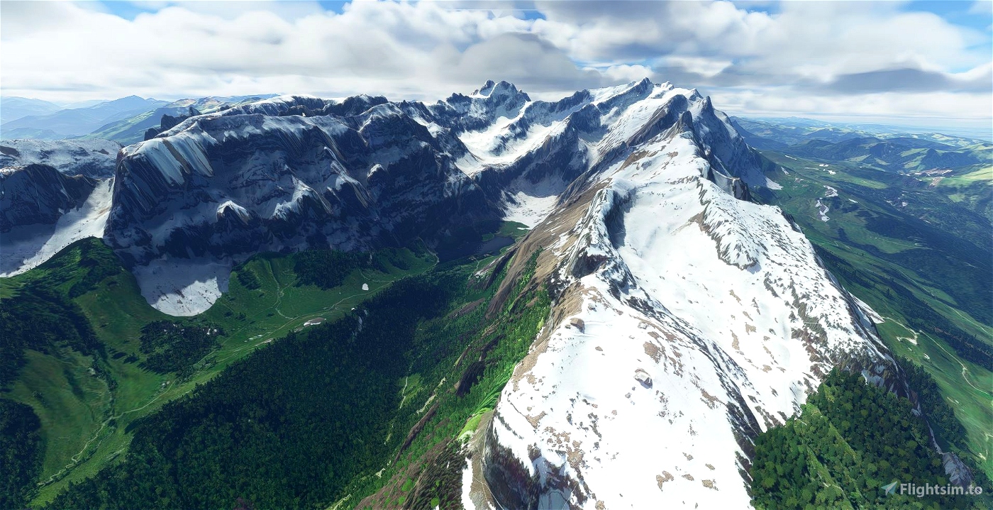
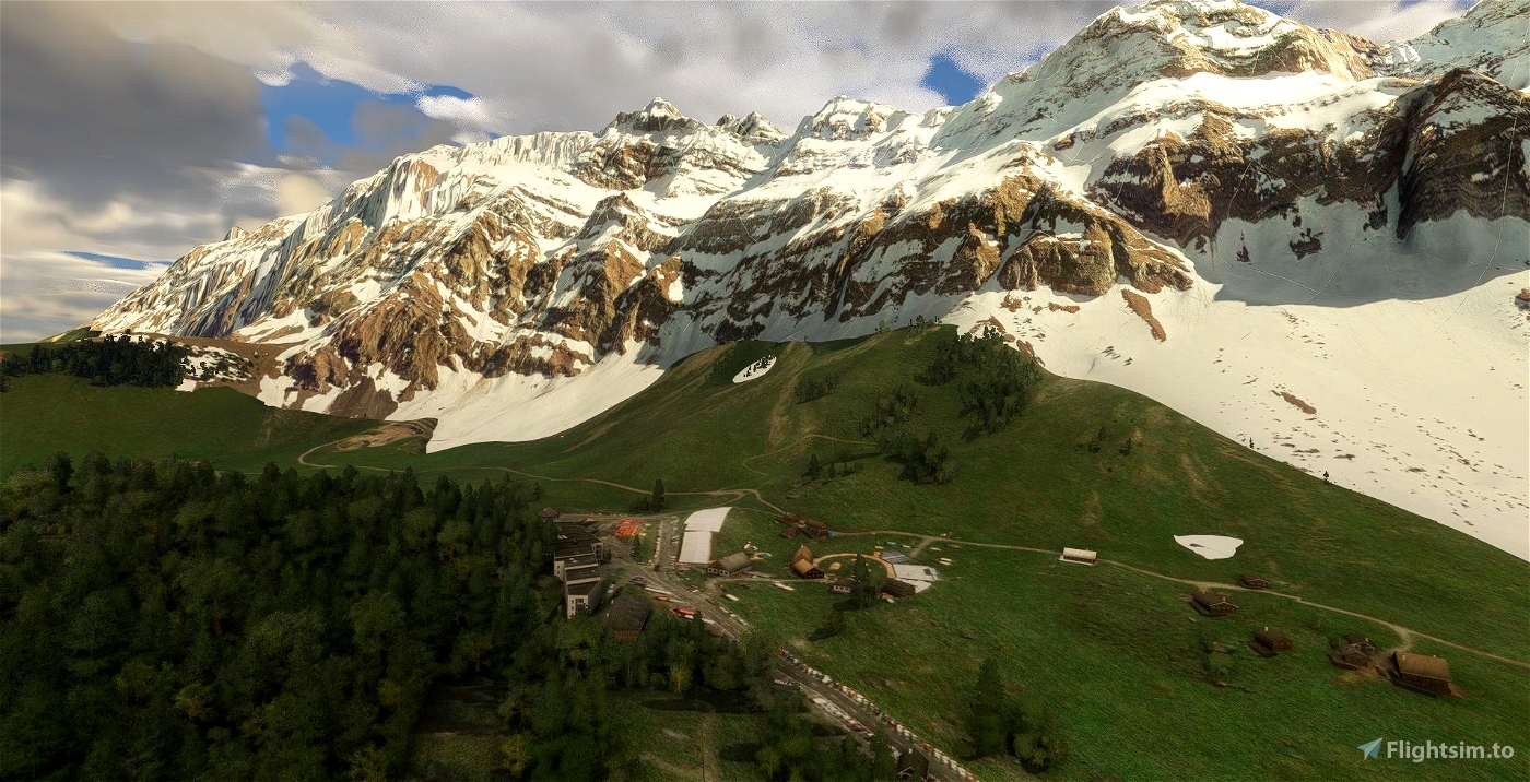
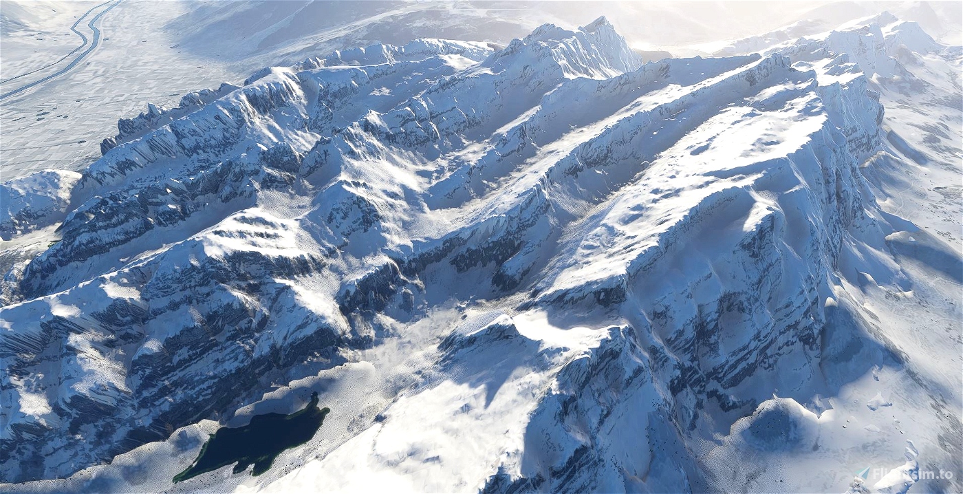
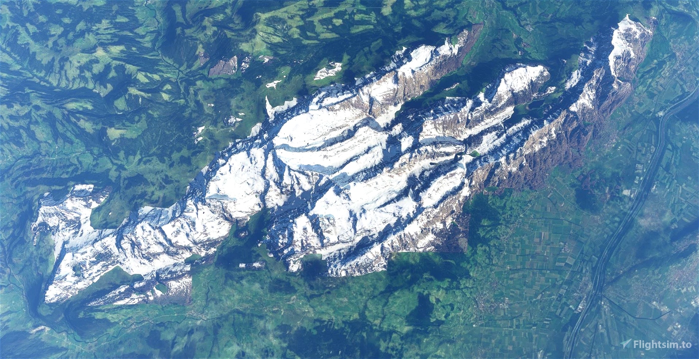
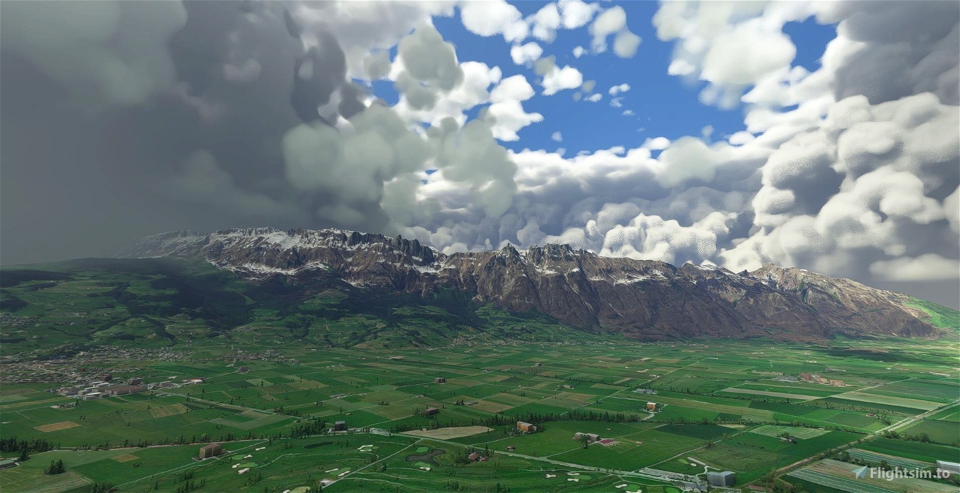
Säntis (Mountain) is located in the northeast of Switzerland and the highest Peak in the Alpstein massiv with an observation deck on its top. The mountain has an elevation of "only" 2,502m (8,209 ft), but the massiv is very exposed only surrounded by hills, what causes a very rough weather. From the top, six countries can be seen: Switzerland, Germany, Austria, Liechtenstein, France and Italy. The edged ridge and the green hills are a paradise for hiking and paragliding. Once the mountain range was in a preselection for Swiss Airforce as a practice area, but we are happy the title went on Axalp nearby Interlaken. Now its a playground for us in the Sim! The next Airports are Flughafen St. Gallen Altenrhein LSZR, Flugplatz Mollis LSZM (Swiss Airforce) and Flugplatz Bad Ragaz LSZE. Other landmars nearby are Churfirsten (mountain range in the south) and St. Gall (City in the north). Both can be downloaded here.
GPS: 47°14′57.73″N 9°20′35.92″ECoordinates: 47°14′57.73″N 9°20′35.92″E Coordinates: 47°9′7″N 9°17′53″E
File:
After World Update 6 (DACH) this area looks great in the sim and works much more stable without adding this file. There is no need anymore to download it.
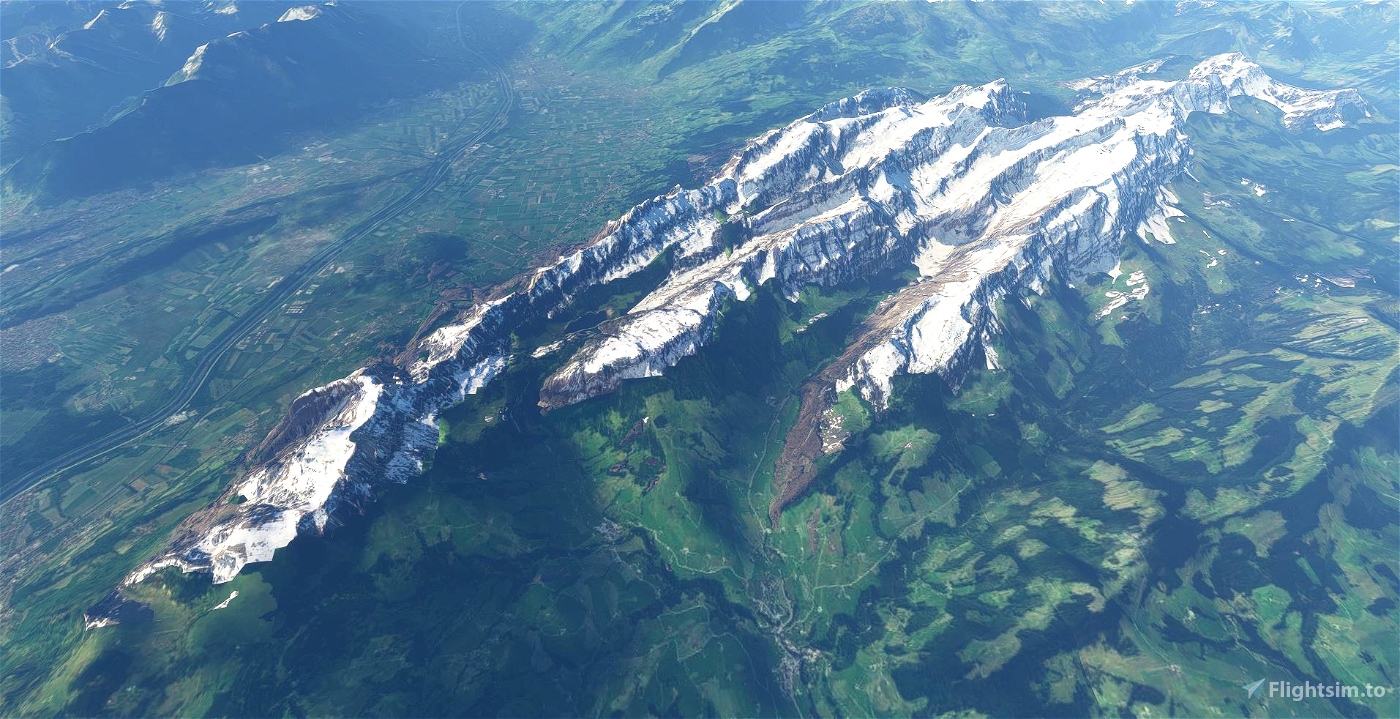
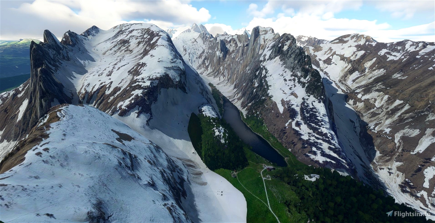
The Scenery is a mix of two seasons. The Google Data are shot in Winter, the MSFS Data look like Summer. For the moment the observation deck and antennas on top of Säntis and Hoher Kasten are missing. I know, it is very large (a span of nearly 20km), so i had to split it in four areas. You can use only Scenery_Alpstein_Saentis with the highest peaks, or you combine it with the whole mountain range.
Credits:
This scenery has been extracted from Google Maps, hence all 3D credits goes to Google.
This scenery has been generated with the Google Earth Decoder tool (credits to /u/Jonahex111):
https://www.reddit.com/r/FS2020Creation/comments/j3faaj/google_earth_decoder_now_userfriendly/
Thanks to Kelarius for his Youtube-Video!
Installation:
Extract Scenery_Alpstein_Saentis and move the four files (Scenery_alpstein_saentis, _ebenalp, _hoherkasten and _luetispitz) into the Community folder. Don't forget to restart the Microsoft Flight Simulaor after that. Thats it!


My hiking region in the flight simulator, how nice! As already mentioned here, I also hope for the Säntis mountain station. In advance, I have already started an exploratory tour through the valleys of the Alpstein with the MB339:
https://www.youtube.com/watch?v=WVCJnw-FikQ&t=378s
Meine Wander-Region im Flugsimulator, wie schön! Wie schon hier erwähnt, hoffe ich auch auf die Säntis-Bergstation. Vorab habe ich mit der MB339 schon mal eine Erkundungstour durch die Täler des Alpsteins gestartet:
https://www.youtube.com/watch?v=WVCJnw-FikQ&t=378s
3 years ago
Thanks for your comment. I added your Youtube-Movie to my screenshots. But after World Update 6 there is no need anymore to add my file to the sim. Enjoy flying!
3 years ago
Bruchpilot80
kelarius
Hab dich eben in Konstanz am Flughafen getroffen.....
Wie überzeuge ich dich Radolfzell meine alte Heimat zu bauen?
3 years ago
3 years ago
Bruchpilot80
Foxtrrap
I have to say though, on my midrange computer, I can't really use it in VR. The performance is way to low, framerates drop like a stone when I get close to the area.
Let's hope Asobo will work on the alps soon. They really have to. The whole Swiss, Austrian and Italian Alps definitelly need to be improved massivly.
The data exists... let's hope they will use it.
3 years ago
3 years ago
Bruchpilot80
THEOLI4D
3 years ago
3 years ago
Bruchpilot80
sualk62
aber auf jedenfall ein riesenspass, die seen im alpstein abzuklappern 😊
3 years ago
3 years ago
Bruchpilot80
hoisserl
3 years ago
Bruchpilot80
Vielen Dank für Deine Arbeit
3 years ago
3 years ago
Atkamen
hoisserl