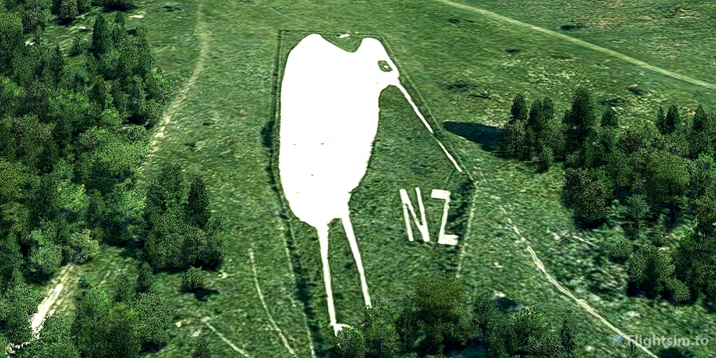
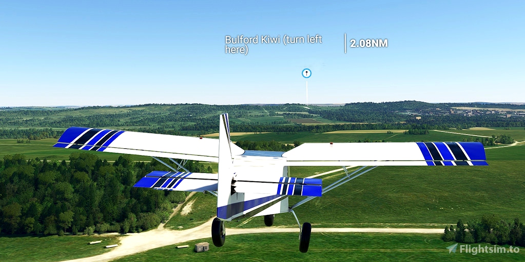
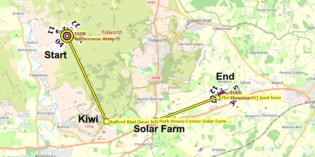
The Bulford Kiwi is a large depiction of a kiwi bird, carved in the chalk on Beacon Hill above the military town of Bulford, England. It was created in 1919 by soldiers of the New Zealand Expeditionary Force who were awaiting repatriation following the end of the First World War. It is one of the few hill figures in Wiltshire to be neither a white horse nor a military badge.
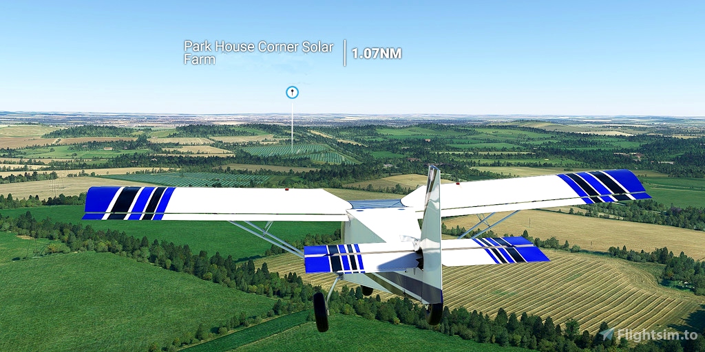
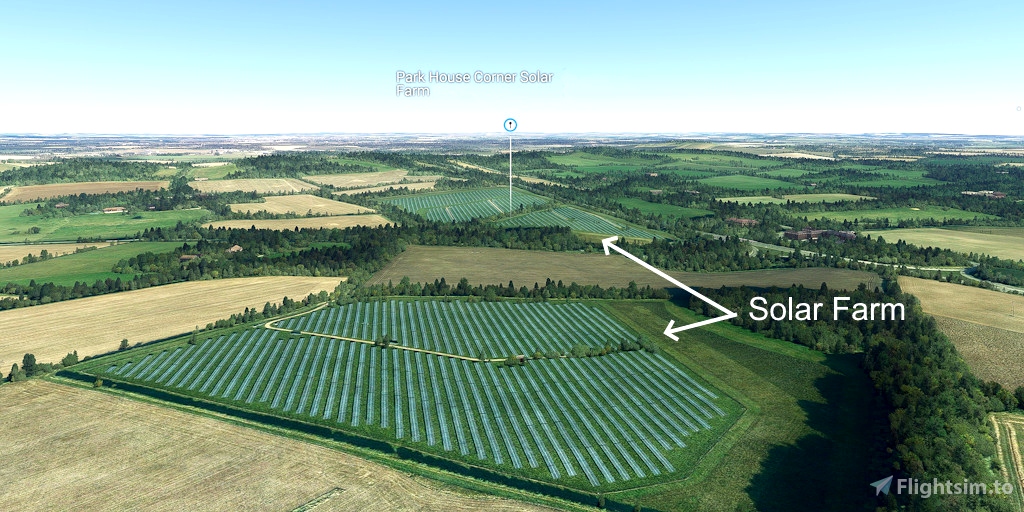
Park House Corner Solar Farm is a 5.4 megawatt Solar power station in Shipton Bellinger/Tidworth. In the simulation the solar farm is auto-generated by MSFS; it is not hand-crafted scenery.
Runway that departs in the direction of the flight plan: 11
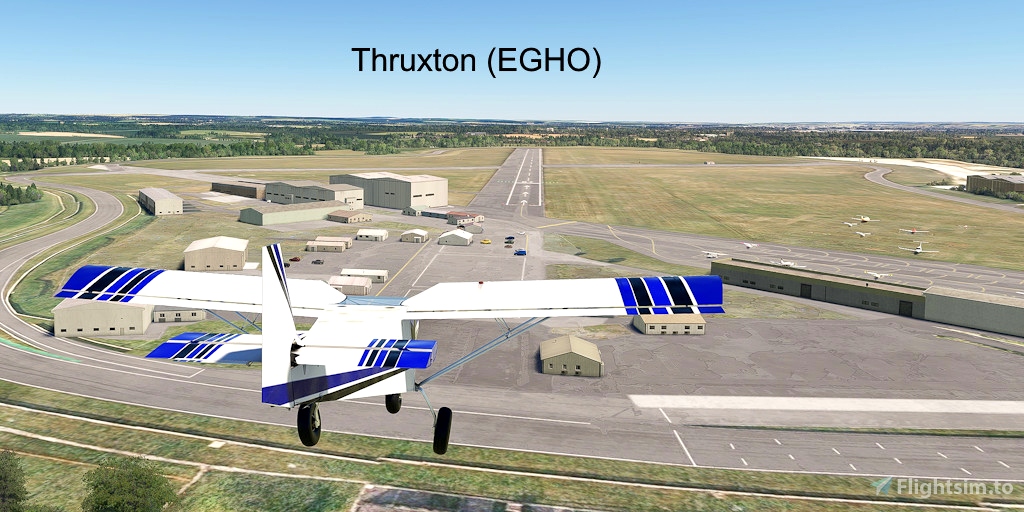
Distance: 8 miles
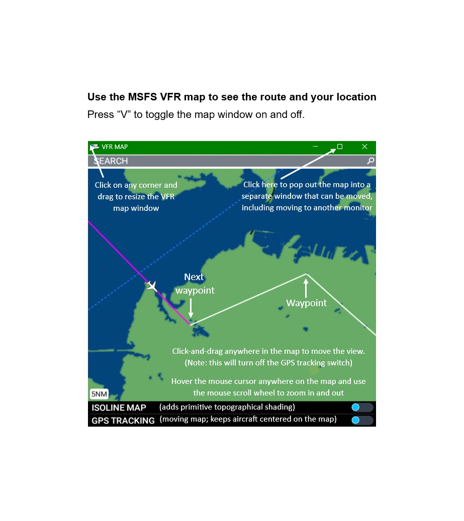
No navigation or GPS instruments are required; simply follow the on-screen markers.
Do not engage the copilot or autopilot. They may alter or suppress waypoints.
MSFS settings for the best experience with this flight plan: Options > Assistance Options >
- Piloting > AI Radio Communications (ATC) > Off (required to properly display the waypoints)
- Navigation Aids > Route and Waypoints > On
- Points of Interest > Landmark Markers > On
- Points of Interest > City Markers = Off (optional - declutters the screen)
- Points of Interest > Display Direction to Chosen POI > Off (disables the confusing destination marker)
- Points of Interest > Display All Labels > Off
- User Experience > ATC Enforce Flight Plan > On (prevent current conditions from overriding selected runway number)
How to Use This Flight Plan
- Unzip the downloaded file into any folder.
- The flight plan is the file that has the “ .pln ” filename extension.
- MSFS > Welcome tab > World Map > Press Spacebar twice (More > Load) > Load From ...
- Navigate to where you saved the flight plan and select it.
- In the "From" airport, select the departure runway (provided in this description, above).
- Click on the Flight Conditions window at the top right to adjust time and month.
- Click on "Fly" at the bottom right of the screen.

 FederFlyer

