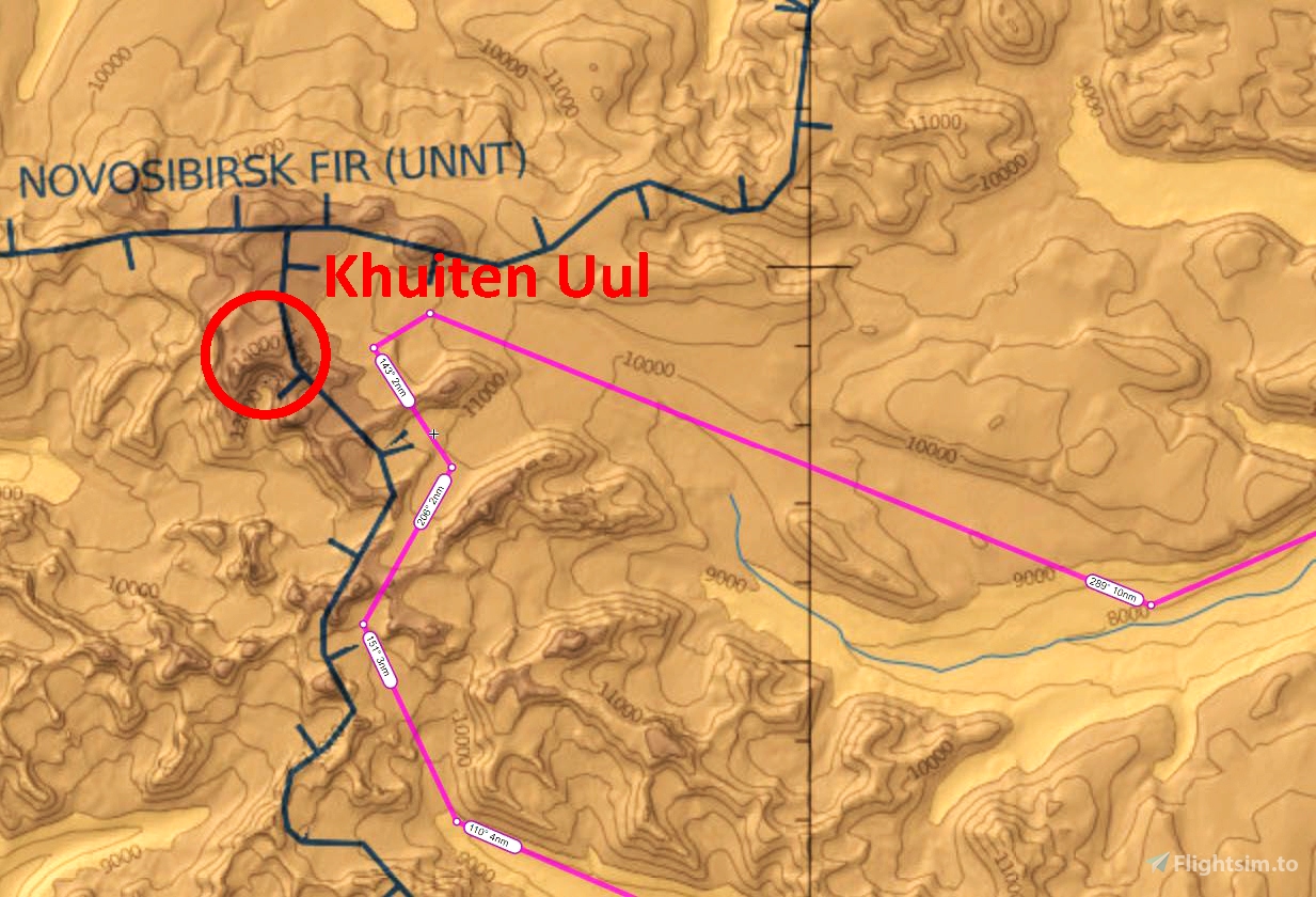

Altai Tavan Bogd National Park is a scenic gem located in the far northwest corner of Mongolia. It stretches from the Tavan Bogd massif in the north, south to the twin mountain lakes of Khoton Nuur and Khurgan Nuur, both of which are over 6800 feet (2070 m) in altitude. The highest peak in the Tavan Bogd (“Five Saints”) is Khuiten Uul (“Cold Peak”) at 14,291 feet (4356 m). Khuiten Uul sits on the border with China near the point where the borders of China, Russia and Mongolia meet, and is called Friendship Peak in China. Snow-covered Khuiten Uul is the second highest peak in the Altai mountain range, and the highest point in Mongolia.
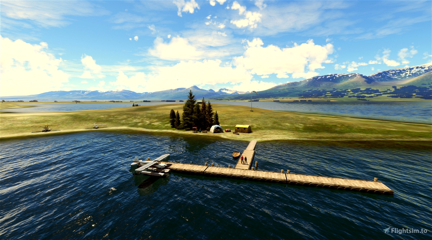
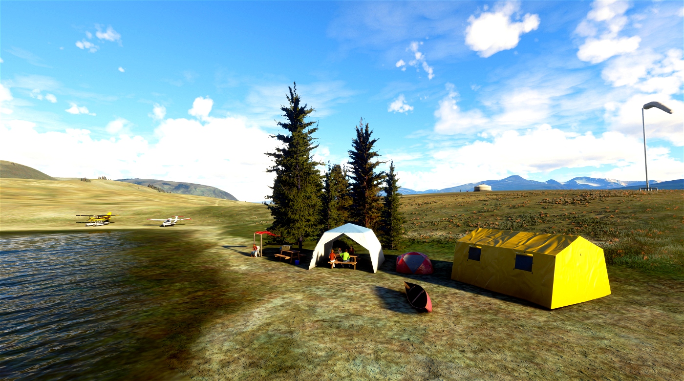
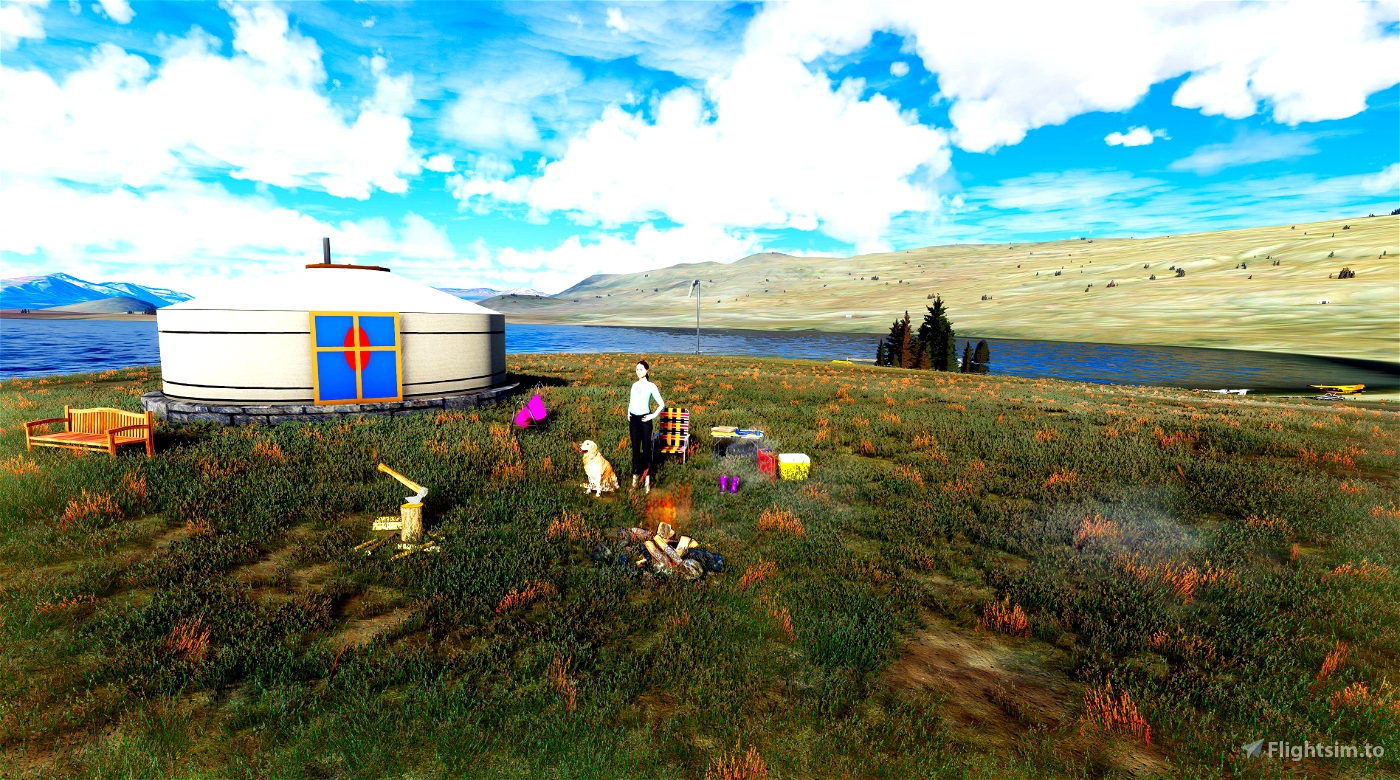
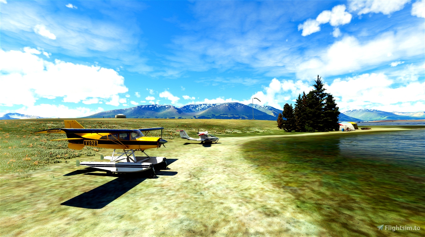
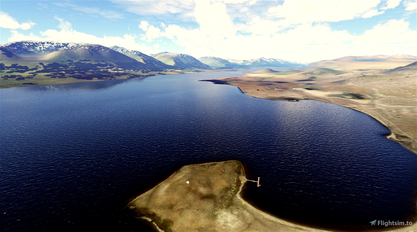
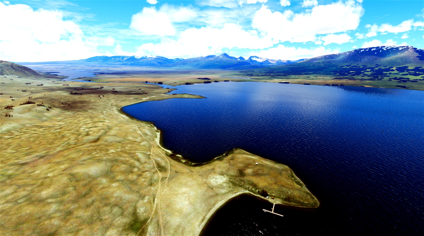
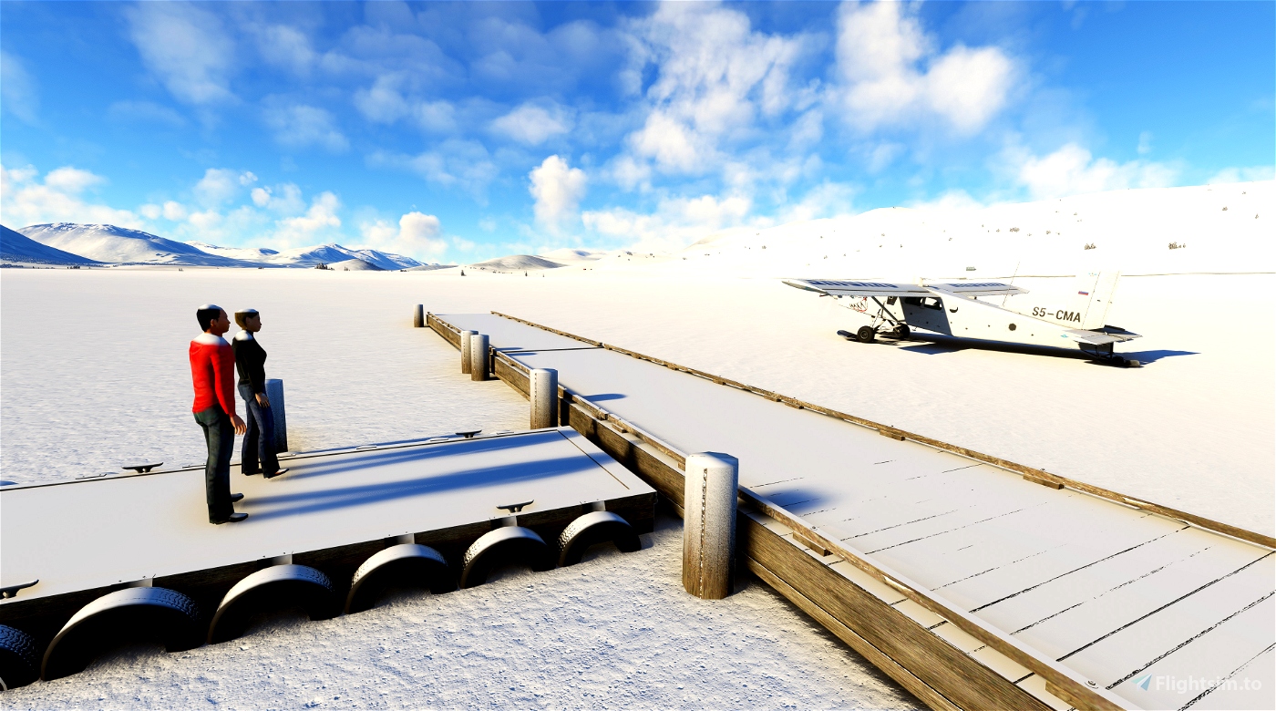
The Khoton Nuur Float Plane Dock is located at a lovely spot on the southeast shore of the lake where you can stop and set up your camp for the night, or bring your canoe and explore the lake. The facilities are limited to the dock, a couple of picnic tables, a small boat, and a ger situated at the top of a hill with beautiful views of the lake, both to the north and to the south, and of sunsets over the mountains to the west. The dock is not far from a rough road that runs up the east side of the lake, so be sure to arrive in the morning if you want to lay claim to the ger, or you may be beaten to it by visitors on horseback. A ranger station lies about 3 miles (5 km) to the south on the Sirgali River, which connects the two lakes, and a petrol station sits at the junction where the main road heads up the west side of Khoton Nuur. It’s about a five day ride by horse (or a six day hike) up the east side of the lake, then along Tsagaan Us gol (river) to another ranger station at the base of the Tavan Bogd, and finally to a glacier that cascades down between the peaks.
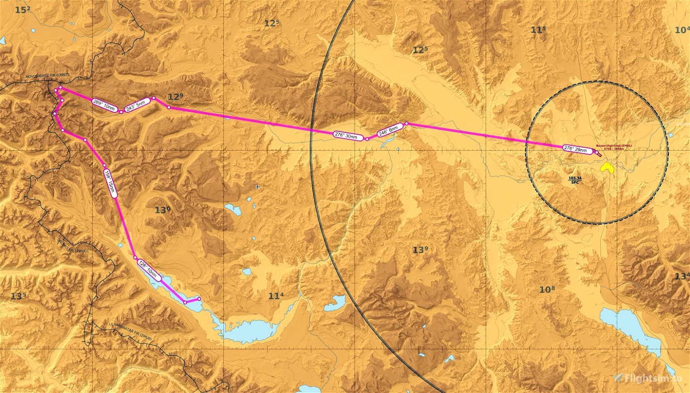
Of course, you have a float plane so you can visit Khuiten Uul without spending five days in the saddle! A spectacular flight by amphibian plane starts at the airport in Bayan-Ulgii (ZMUL - get Blinn’s great implementation of the airport here.) Travel up the river valley to the northwest all the way to the triple border junction and then swing south past Khuiten Uul, and finally follow the river to Khoton Nuur and to the dock. See the maps. You can also explore Khurgan Nuur and the other small lakes to the south. You will need a plane that can climb above 13,500 feet in order ot clear the ridges near the massif – the Maule handles the flight with no gripes, or you can choose a turboprop such as the Kodiak 100.
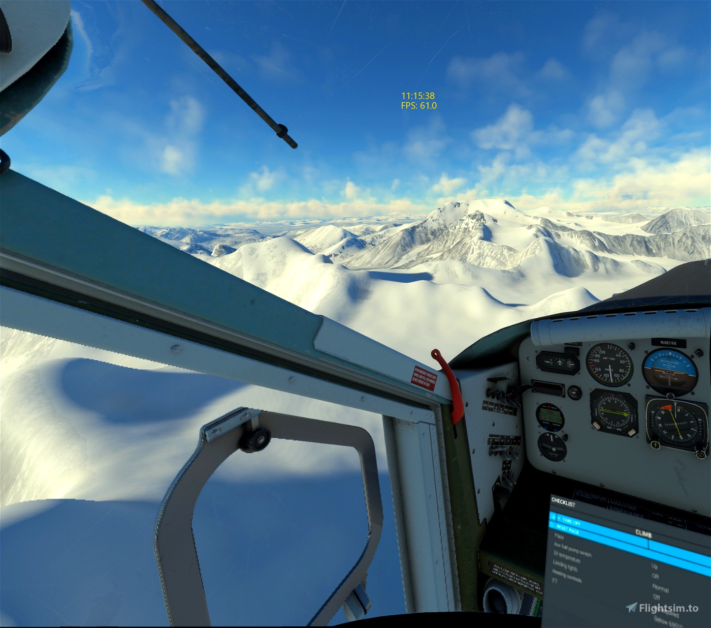
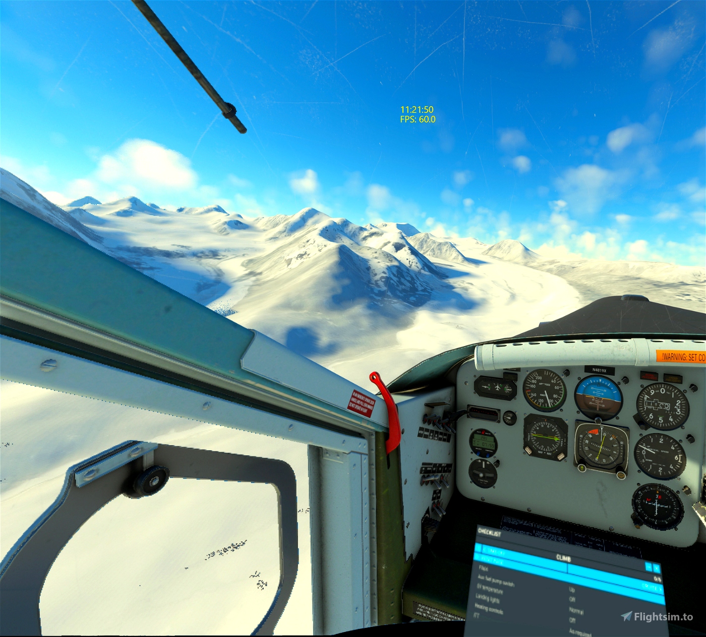
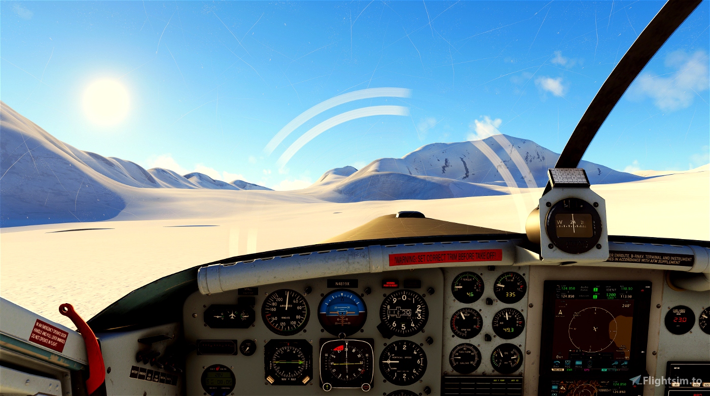
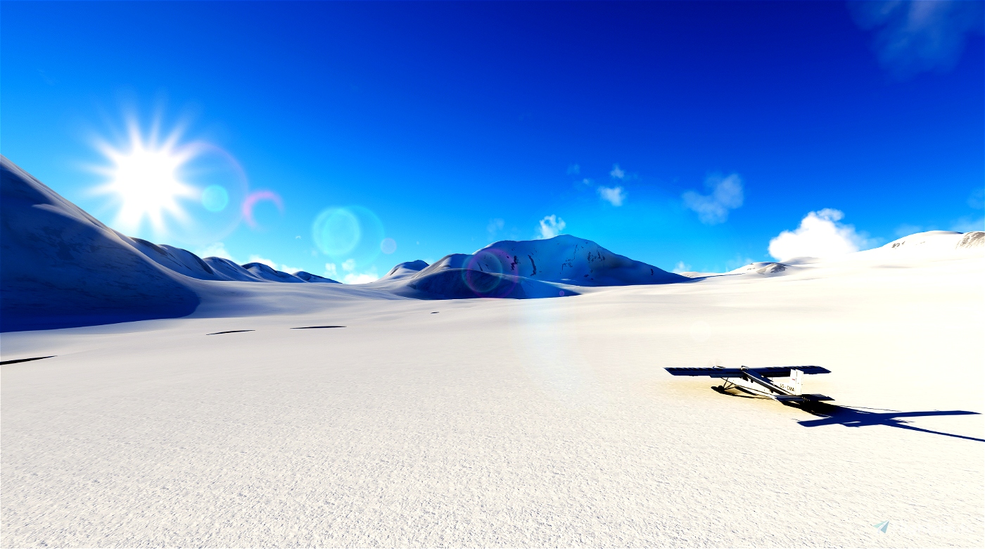
For a real adventure, fly the route in the winter with a ski plane. You can land on the glacier at the massif, and then head to the frozen lake where you can land and tie up at the float plane dock or on the beach. I flew this route in the Blackbird Pilatus Porter, but in the reverse direction, starting at the dock. See the photos. There is a smooth area on the main glacier at about 11,000 feet that makes a wonderful landing spot.
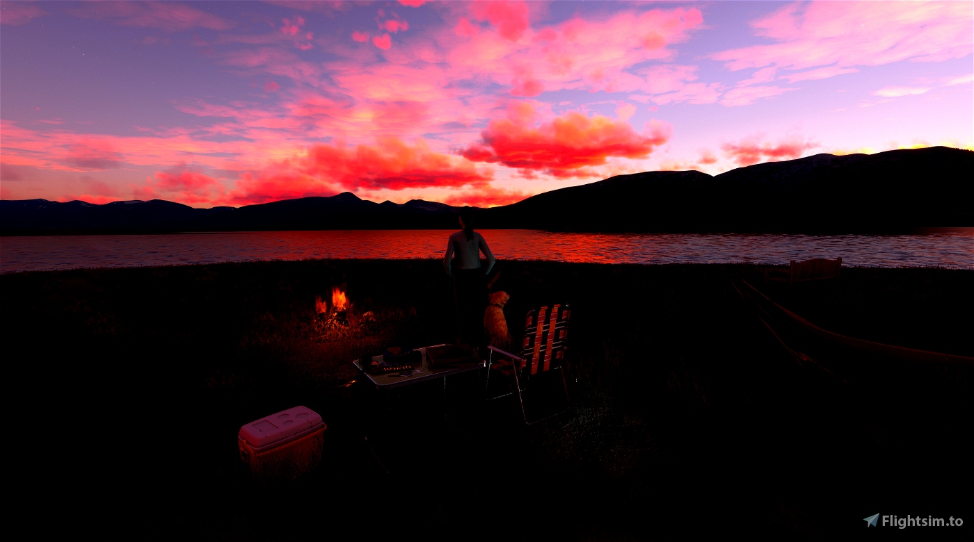
I have implemented one water runway near the float plane dock for you to spawn at, but in practice just choose a direction into the wind for takeoff and landing. There are also two parking spaces, one located at the dock and one on the beach. You can bring an amphibian up just about anywhere along the shore near the dock and can also beach your float plane there. The camp located near the trees is a permanent part of the scenery, as is the ger up on the hill. The camp near the ger is from the Parallel 42 Campout Utility, and won’t appear in your scenery. It’s a great spot to set up your own camp to watch the sunset!
NOTES
To install the airport, unzip and place the folder titled "mulberrywing-airport-zmkn-khoton-nuur-floatplane-dock" in your community folder.
To see the float plane dock you will need to download the Seaplane Asset Library from flightsim.to and place it in your community folder. Many thanks to 30West for providing this great library!

 MulberryWing

