Jan Mayensfield ENJA
Jan Mayen is a volcanic island of norwegian dominion, located in the north atlantic ocean,950km west of Norway, 600 km north of Iceland.
Current crew is a total of 18, running the Galileo and Egnos stations, the meteorological station and maintaining the infrastructure - buildings, roads, airstrip, power station and so on.
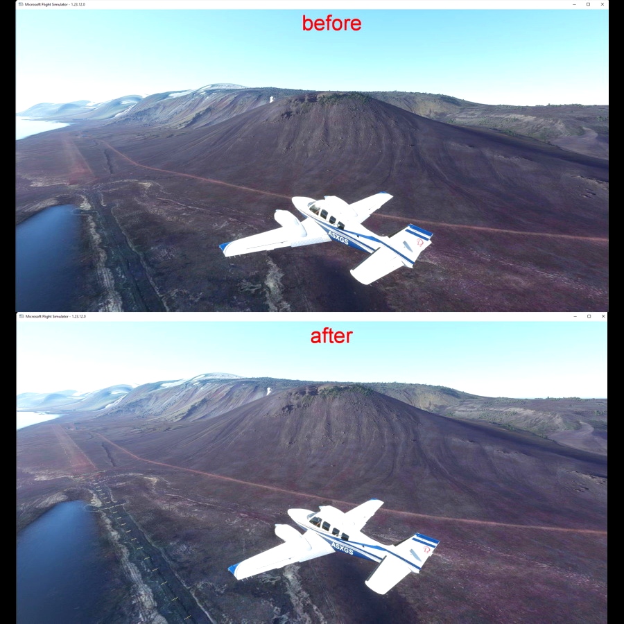
The view of the island is dominated by the active volcano, Beerenberg (2277m),which had its last eruption in 1985.
Part of Norway located in the polar circle, Jan Mayen is a challenging place for pilots who love short landings and difficult approaches.
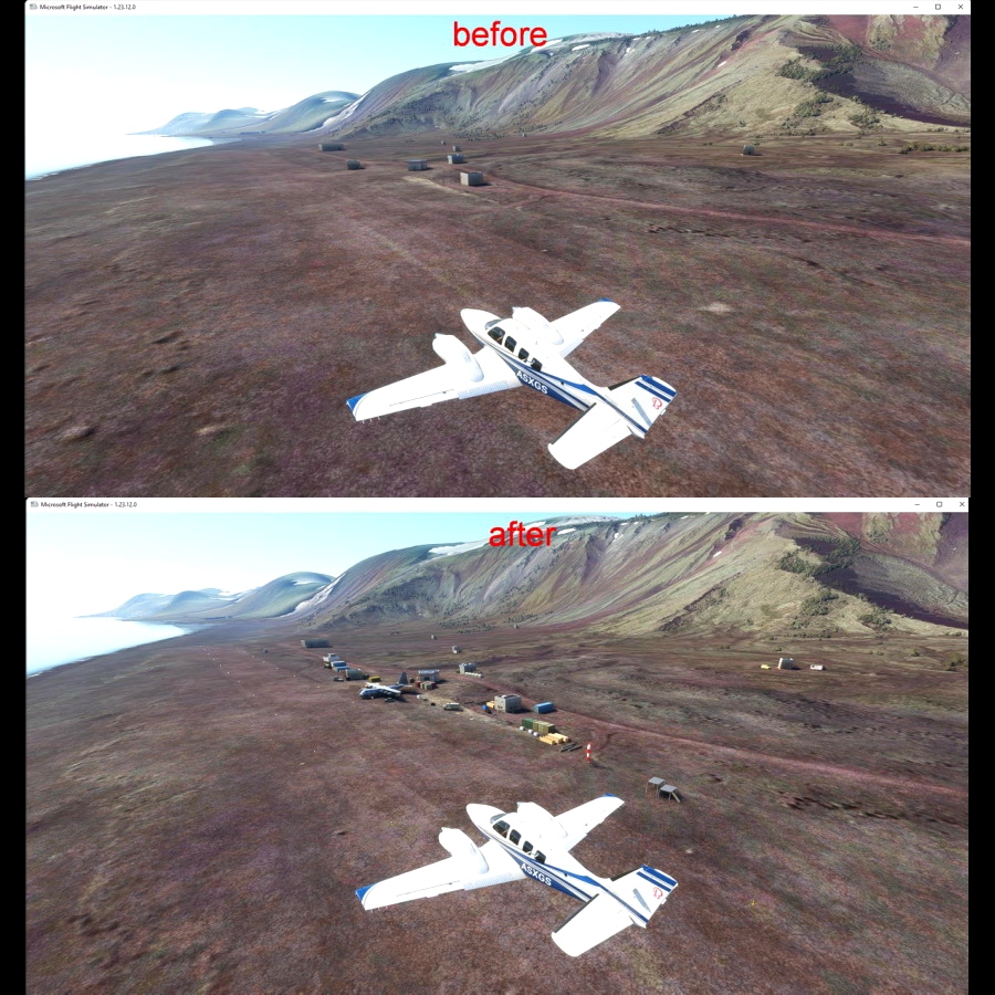
Olonkinbyen (literally The Olonkin Town) is the only settlement on the Norwegian island of Jan Mayen (aside from isolated cottage huts such as Puppebu).
country Norvège, Jan Mayen island
town Olonkinbyen
airport type Military and scientific use
Coordinates: 70°55'14"N 8°43'8"W GPS : 70.943769, -8.666226
Elevation: 12 m (39 ft)
Magnetic Variation: 6.7 W (as of December 2021 from WMM2020 model)
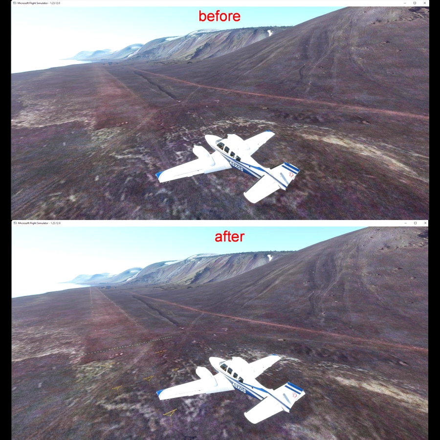
runway 06/24 1 600x30 m (5 250x100 ft) gravel
Jan Mayen NDB: JAN freq:362
v1.0
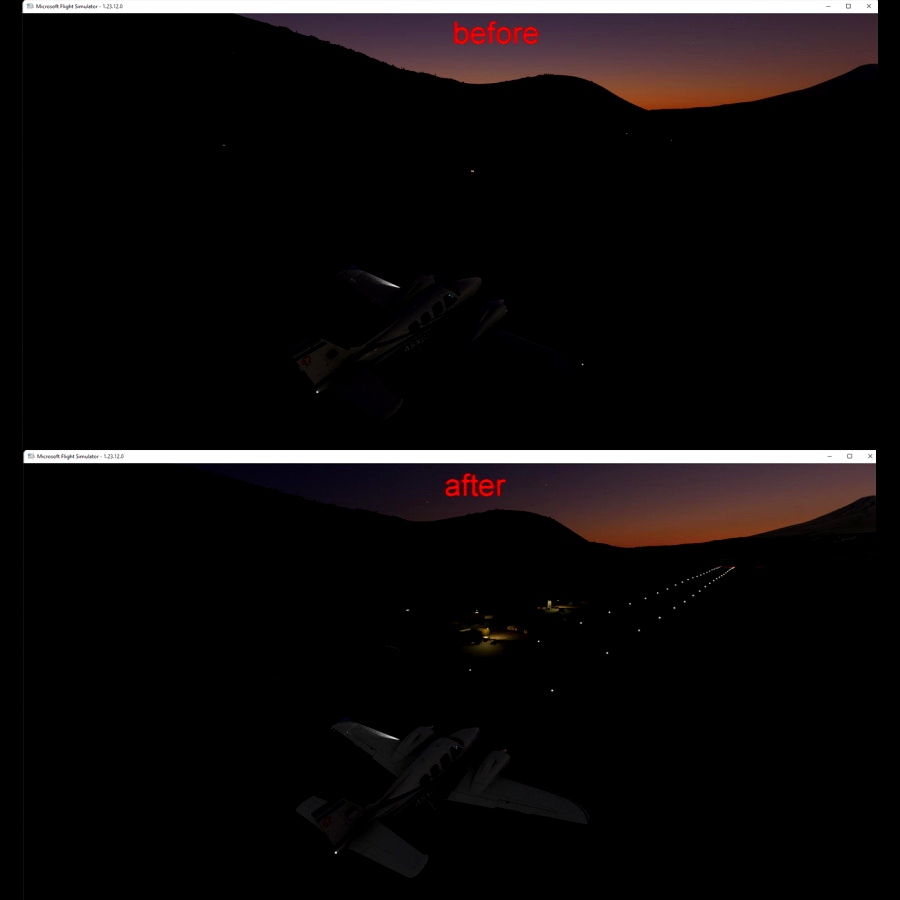
1..added runway at the right elevation and runway lights (as it should be in real life)
2..night lighting
3..added various buildings and objects
4..added windsock
5..added NDB (freq : 362)
6..added building and objects for meteo station located southwest of the island
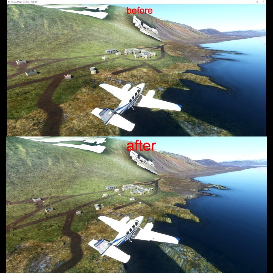
7..created cliffs at Olonkinbyen (the only settlement on the island which also holds a weather station and radio station)
8..added some vegetation

 timot75


Many thanks from Warstein in Germany for this well-improved and far away located airport 😊
2 months ago
CaptainMoonlight
Could you add one or two parking spots?
5 months ago
RideroftheMark
Thank you, a real challenge to fly to ENJA! 😊
12 months ago
JJNav
Thank you, very much! 😊
2 years ago
GiuManz