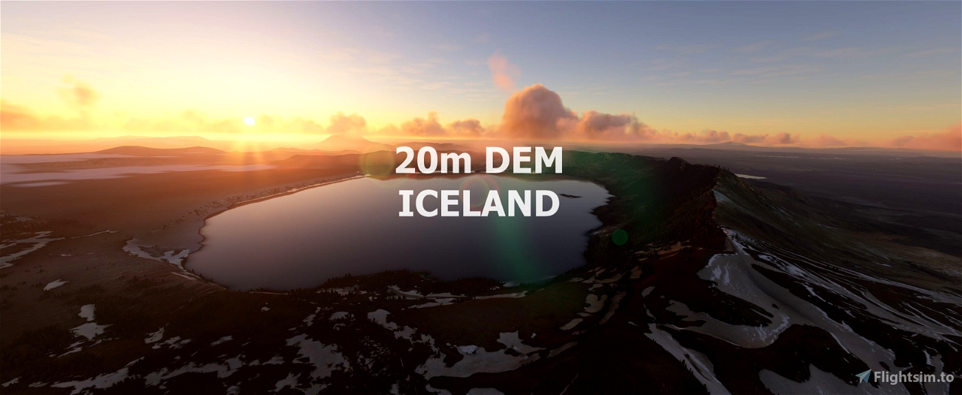
Experience Iceland
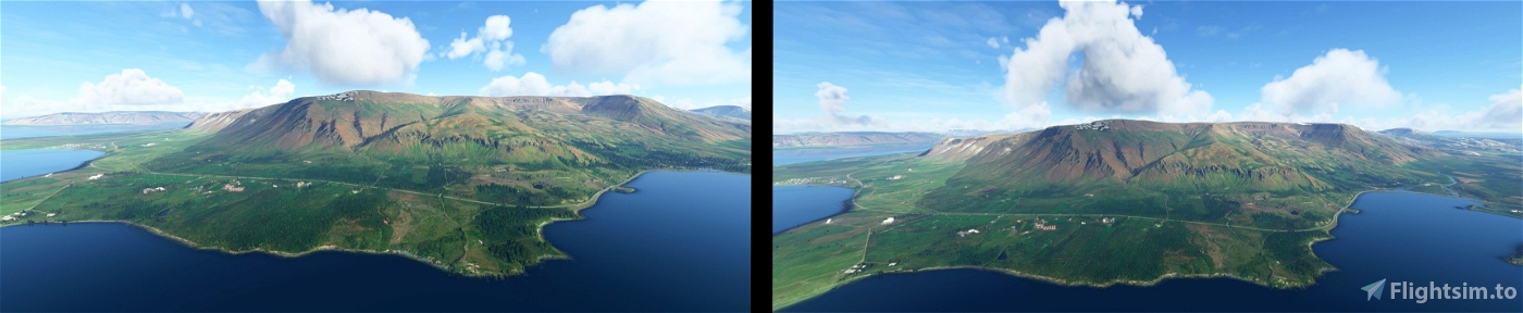
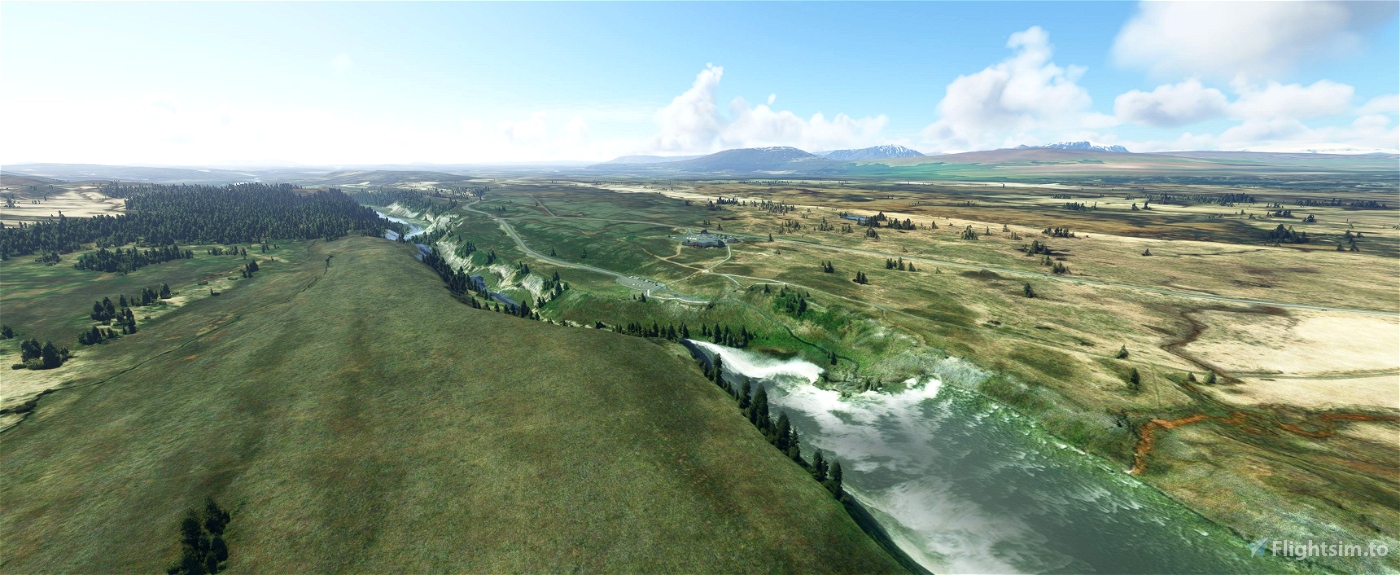
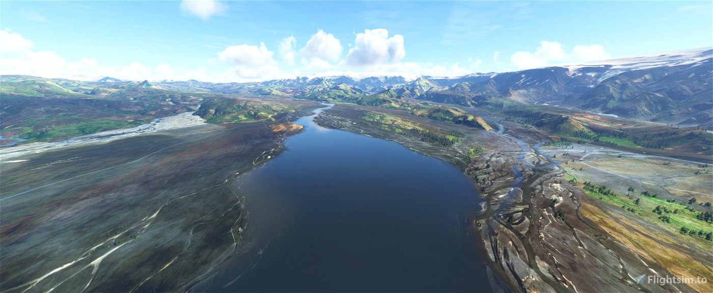
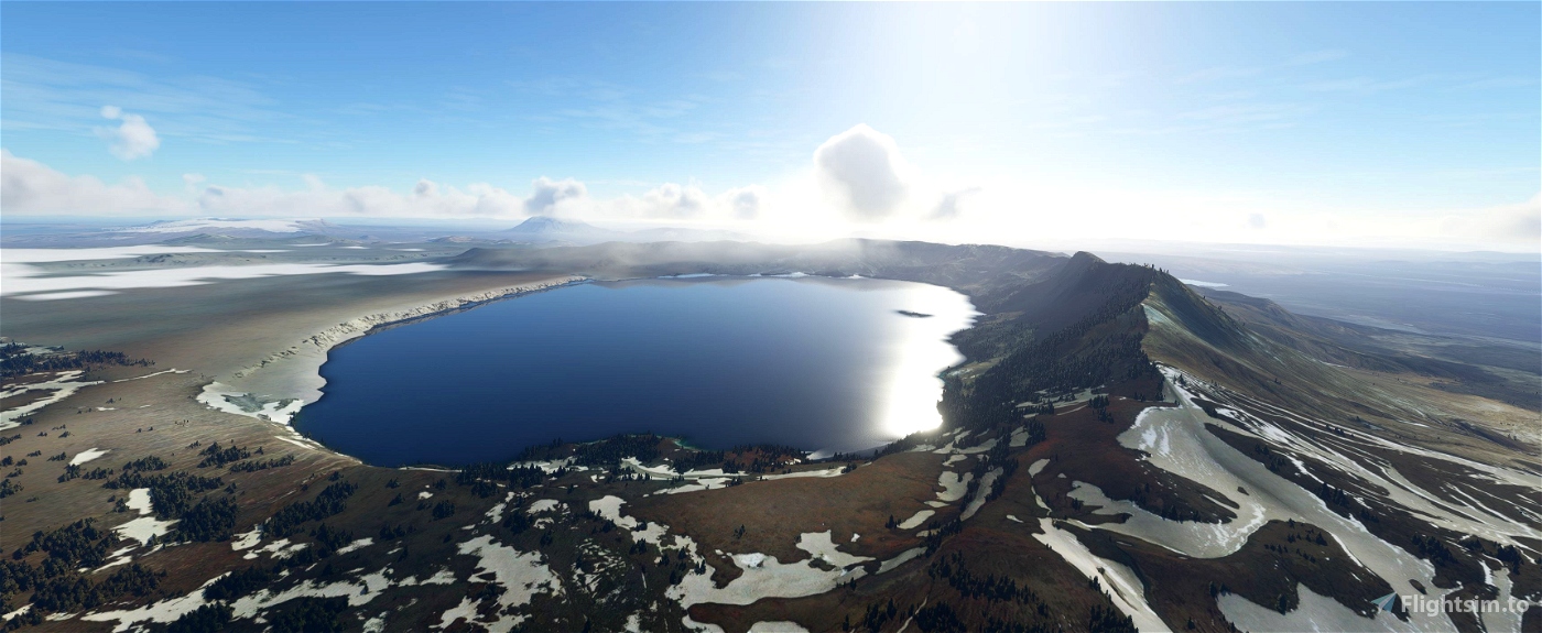
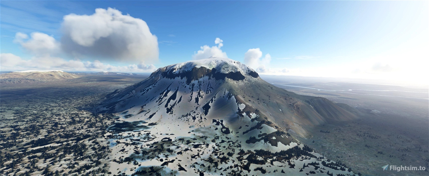
This mod contains customized height profiles. The mod contains high definition LIDAR DEM data and other height profiles with a mesh resolution of 20m.
The mod does not only provide mountain shapes being very close to reality, but also flattens lakes & rivers and gets rid of any terrain artifacts.
IMPORTANT
Disclaimer: The creator of this mod is not responsible for any problems, damage, incompatibilites to other mods or performance issues that might occur.
Please note, that this mod is a very high resolution mesh. The elevation data is applied through terraforming rectangles, thus loaded at a certain distance from the player. When travelling fast or at high alitude (wide range of view) there might be too many new rectangles loaded simultaneously and thus stutters might occur.
If you have any stutters you can try and reduce your ingame render settings or uninstall!
If you are mainly flying airliners in high altitude, there is probably no benefit for you in using this mod.
Credits
The elevation data used was a LIDAR 20m height profile and other height profiles compiled by Sonny (https://data.opendataportal.at/dataset/dtm-europe)
It was then transfered into MSFS using MSFS Toolkit by Nool Aerosystems (https://msfs.nool.ee/)
Thank you both and for anyone reading this: Please go ahead and support them!
Thanks Troglodytus for you help!
Enjoy your VFR flights above Iceland!
Alternative:
maddi made a new DEM mod for Iceland may you check it out some people say that it is less buggy.
https://de.flightsim.to/file/16774/iskort-is-iceland-dem-20m-for-iceland

 Mikea.at


Sonny2
I created a new version of the DTM this scenery is based on. Lots of elevation artefacts ("spikes") within the source data got removed:
"DTM Iceland v2", Download: https://sonny.4lima.de
Mikea.at author
Thanks for your work. The bad thing is that the simulator is not optimized to use terraforming rectangles for a complete country. Maybe sometimes it works. 😁
2 years ago
koyangi
Sorry but not reccomendable. It has extreme Microstuttering since i download this Scenery. Reykjavik is not playable anymore. I deleted it.
MarinoCodes
Works fine
caviwhy
VERY, VERY laggy
maddi
you really should not say this is Lidar data, as I have pointed out to you, it's photogrametry data,
Mikea.at author
This is a free mod no one have to pay a cent for it. I dont get why this is so important for you and as you said it has also lidar data in it. So it is not 100% wrong. But for you i changed the description and the headline ;)
3 years ago
paulhannover
does this collide with World update V? the Icelandic Landing Challenge gives me a CTD 😀
Mikea.at author
right at the moment i dont know if there is a problem with the world update. check it out move it out of the community folder and try it ;)
3 years ago
stebet
if you want to add solid elevation data, here is an official DEM from the Icelandic Geological Survey: https://gatt.lmi.is/geonetwork/srv/api/records/e6712430-a63c-4ae5-9158-c89d16da6361
Mikea.at author
Sony used that source. so basicaly this mode is based on the source you mentioned :)
3 years ago
WildgooseUK
Great Mod but are a few spikes like other members mentioned
flying_coyotus
Thanks a lot !
For info many "pikes" in south, near Vestmann Island for example.
Generally it is near water. Some weird mount of water too in the ocean.
maddi
Please note this dataset is not Lidar data, it is based on photogramerty data from satilite imagary, it is ArticDem data + small amount of lidar for the glaciers. Please respect the original datasource used, the data you used is not lidar, and it is not correctly listed at your source. I guess its not your foult for thinking it is lidar.
Mikea.at author
Hi, i used the 20m dataset from sonny. In his description he writes that the 20m model is only containing lidar data. :)
3 years ago
Knickerjoe
Overall nice work with the elevation data. Thanks a lot!
A big problem due to realism seems, that there are now everywhere trees, even on the black beach near Dyrhólaey, directly to the north atlantic. Iceland has nearly no trees on the soutern coast. Not near Keflavik airport, nor anywhere else up to the Jökulsárlón Glacier. It´s nearly blank.
Additional east and west of Vik there are spikes on the beach, which seem absolutely displaced. Might it be possible to correct these points? 😊
Edit: Icelandoverhaul skips the tree problem, the spikes remain
Edit 2: Deactivation of Icelandoverhaul does not solve the spikes, so its most probably something in the main DEM data 😊
machuca99
Hi,
thank you for this realy nice mesh, but unfortunatly it isn't compatible with the iceland overhaul, there are spikes all over. Vestmannaeyjar looks like a part of the Moon. Some spikes aren't big, but some are realy disturbing, although some holes...
Its very sad, in combination your mesh and the nice overhaul would be a very nice project. But in the moment I will prefer the overhaul hoping that with the next Update came a better mesh from asobo...
Anyway: thanks a lot for your afforts to improve the mesh, its realy neccesary in many parts of the world...
Baddweapon
I'm currently working on making my mod compatible!
3 years ago
jvr009
Thank you for the 20m mesh mod, Iceland is looking better, however not without problems - if you are using BIRK airport by Icesim (freeware) there is sharp edges on ryw 01/19 and the taxiways, you can land a C152/172 but not bigger planes. I use payware BIKF Keflavik Airport from MK-Studios - It works but some of ILS's (ryw01) will put you into the ground before the runway. It is possible to exclude areas for BIKF and BIRK from this nice 20m mesh ?
Mikea.at author
I excluded already a long list of airports. I Will check that. :)
3 years ago
daavids19
Hi guys, doing some research to help you and look for more lidar data I found the country of Wales with lidar data up to 25 cm and many other resolutions I pass you the link, covers the whole country, even though it is also specified for each discharge which area of the country is covered, but it is very complete.
If you want I continue investigating more countries, but it is difficult to find free download data.
http://lle.gov.wales/GridProducts#data=LidarCompositeDataset
Im from spain it is not my country
and I have a question, which is better DEM, DSM or DTM? are they all compatible with what we can pass to fligth simulator? looking for information I think the most complete is the DSM because it has more data, rivers etc
flying_coyotus
You have copernicus project
https://land.copernicus.eu/imagery-in-situ/eu-dem/eu-dem-v1.1
3 years ago
Nephron10
Great 😊 Herðubreið, Askja, Súlur and numerous others looks so good ! Ty, ty, ty