Specially for VFR flying Netherlands.
Arnhem Landmarks.
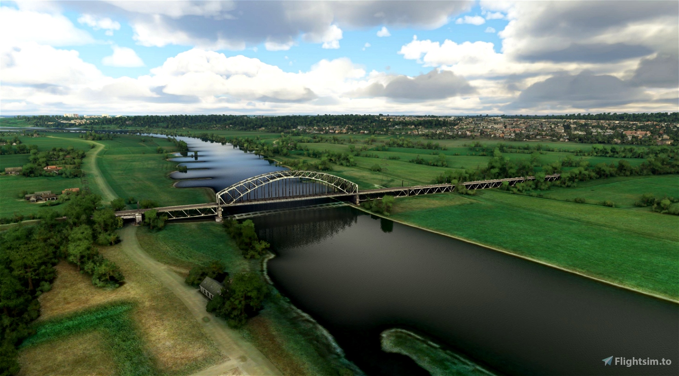
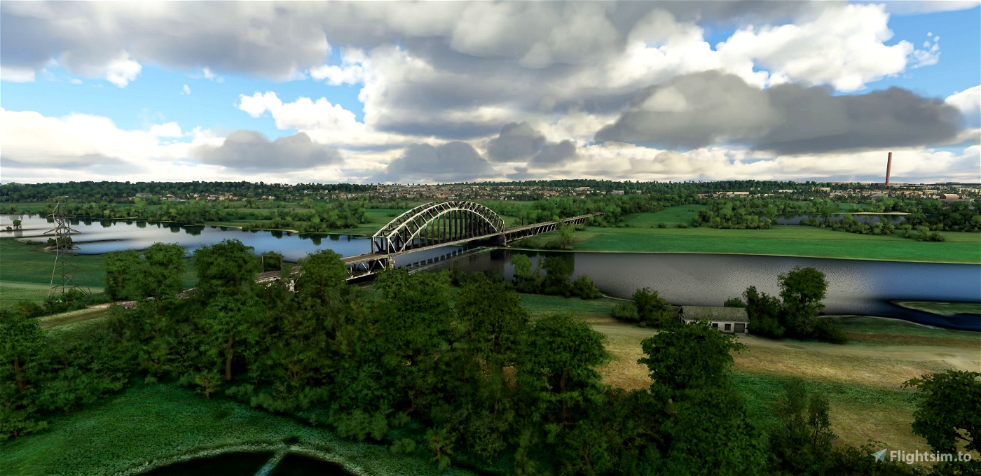
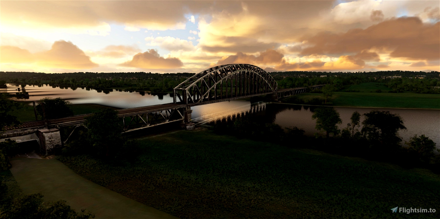
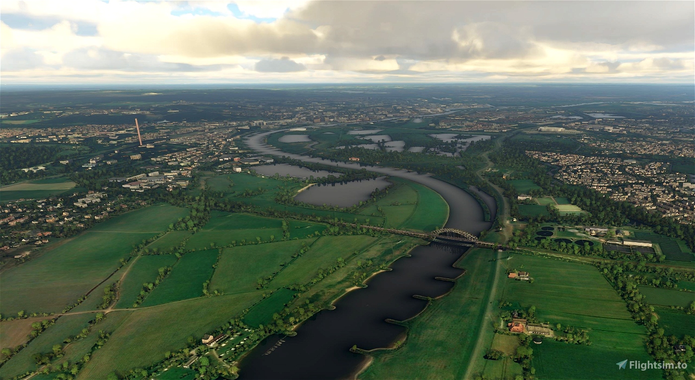
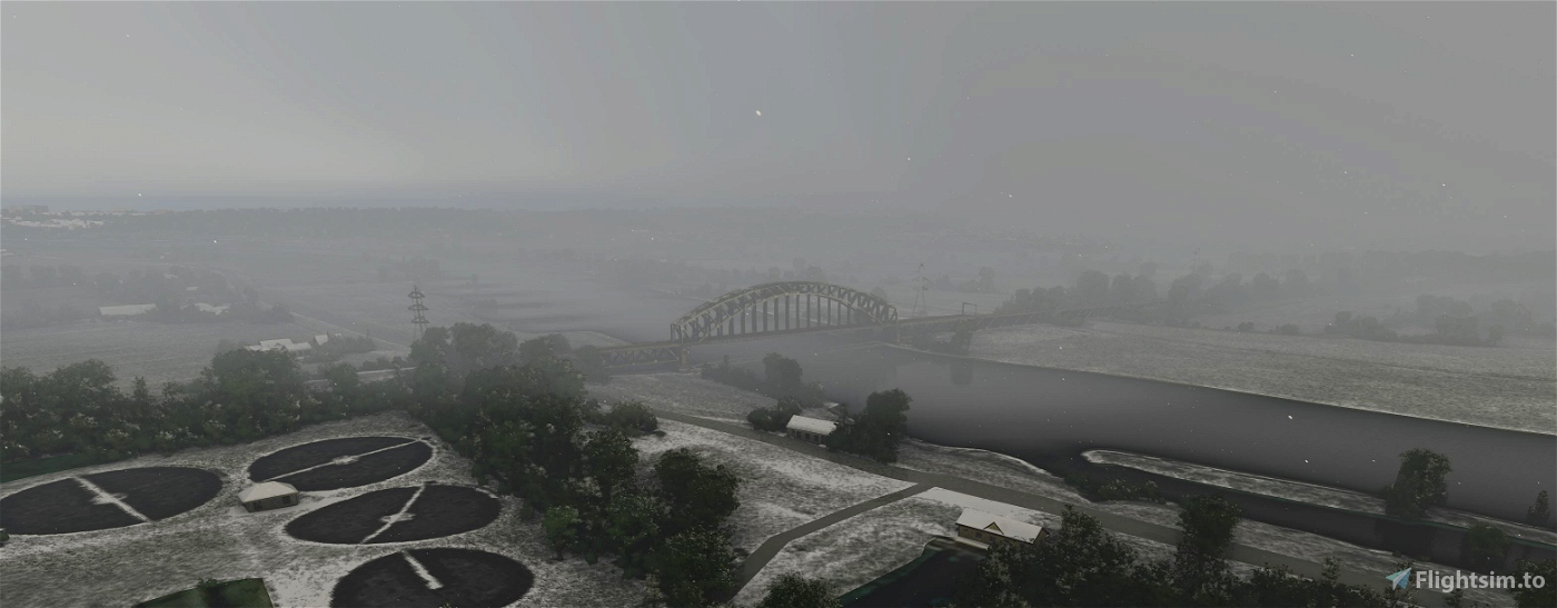
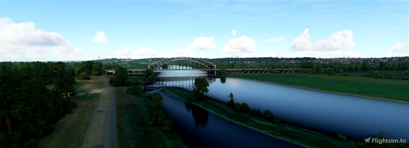
Spoorbrug Oosterbeek (Railway Bridge Oosterbeek)
The Oosterbeek railway bridge over the Nederrijn near Arnhem is part of the Arnhem - Nijmegen railway line. The bridge consists of five landing bridges on the north side, an arch bridge over the river and an approach bridge on the south side. The landing bridges are all 56 meters long and the main span is 132 meters. On the north side of the river, the railway line runs along the municipal boundary through the Rosandepolder, on the south side it separates the neighborhoods Elderveld and De Laar on the east side and Schuytgraaf on the west side.
History
The current bridge is the fifth version. The first railway bridge was built in 1879 to a design by ir. J.G. van den Bergh and had several arches and an extra pillar in the river. On May 10, 1940, the bridge was blown up during the German attack, and on November 19 the destroyed bridge was replaced by a bridge from Zaltbommel by the German occupiers. Because it consisted of only one track, signal booths were erected on both sides of the bridge from which train traffic was regulated. However, the bridge was destroyed again during the Battle of Arnhem, and then replaced by a temporary bridge from Dordrecht. In 1952 it was replaced by the definitive bridge as it still stands today.
(source Wikipedia)
-----------------------------------------------------------
File credits
This free creation contains content from Google Maps or Google Earth. In accordance with Google Terms of Services and especially point 2.2 of Google Maps/Google Earth Additional Terms of Service, this creation is based on « fair use » or « fair dealing » of the data provided by google throught its services. No commercial use or any gain is or will ever be made by the author of this creation, who doesn’t own anything regarding google assets but a simple user Licence. According to the following document https://www.google.com/intl/en-GB/permissions/geoguidelines/, the author is freely sharing a creative application of Google Maps or Google Earth. The author will not recieve any form of retribution for sharing his work, even general donations from users of file hosting web services under the form of « rewards » or « tips ». If this content would be found somewhere where it is provided in exchange of money or any kind of retribution, I wouldn’t be with the consent of the author who will stick to strict free content creation diffusion.
Part of this content including 3d data and textures is copyrighted by
Imagery ©2020 Google, Imagery ©2020 CNES/ Airbus, Maxar Technologies,
USDA Farm Service Agency, Map data ©2020 Google.

 Geraldar98


Got some very fond memories of this bridge
3 years ago
FreeThinker
4 years ago
Reint161
4 years ago
4 years ago
Geraldar98
jpht64
4 years ago
Flyingdutchie